Potential issues, identified early
Available flood, wetlands, soil, and environmental maps help identify questions that may affect your plans.

Preliminary Site Intelligence
A property can look right and still leave important questions unanswered. Get the available records organized around what you want to do—buy, build, expand, or change its use.
Confirm your property and scope before secure payment.
Available flood, wetlands, soil, and environmental maps help identify questions that may affect your plans.
Available zoning, permit-office, and utility information helps you work out who to contact and what to confirm.
Findings, missing information, and follow-up questions in one report you can share with your designer or project team.
We look up available maps and records for the site you select. We summarize the information found, explain why it may matter to your plans, and identify what still needs confirmation.
We accept sites across all 50 states. Available records vary by location; we check whether the required information can be retrieved before accepting your order. A missing record is never treated as proof that an issue does not exist.
If you provide measurements, the report can distinguish existing roofs and pavement from proposed additions. These hard surfaces are called impervious area because water cannot readily soak through them.
The limit of disturbance is the area affected by clearing, grading, excavation, and other construction. It is different from paved area. These details help identify stormwater questions that could add design work, cost, and time. Local requirements still need confirmation; unknown measurements stay unknown.
See the report
This approximately eight-page example shows the findings, supporting records, and follow-up questions for an illustrative addition to an existing property.
The records are real; the proposed project is hypothetical. It is an example, not a customer result or property approval.
View sample PSI report (PDF, opens in a new tab)Have a property in mind? Share its location and the decision you need to make. You will confirm the map and scope before payment.
Start a report for one property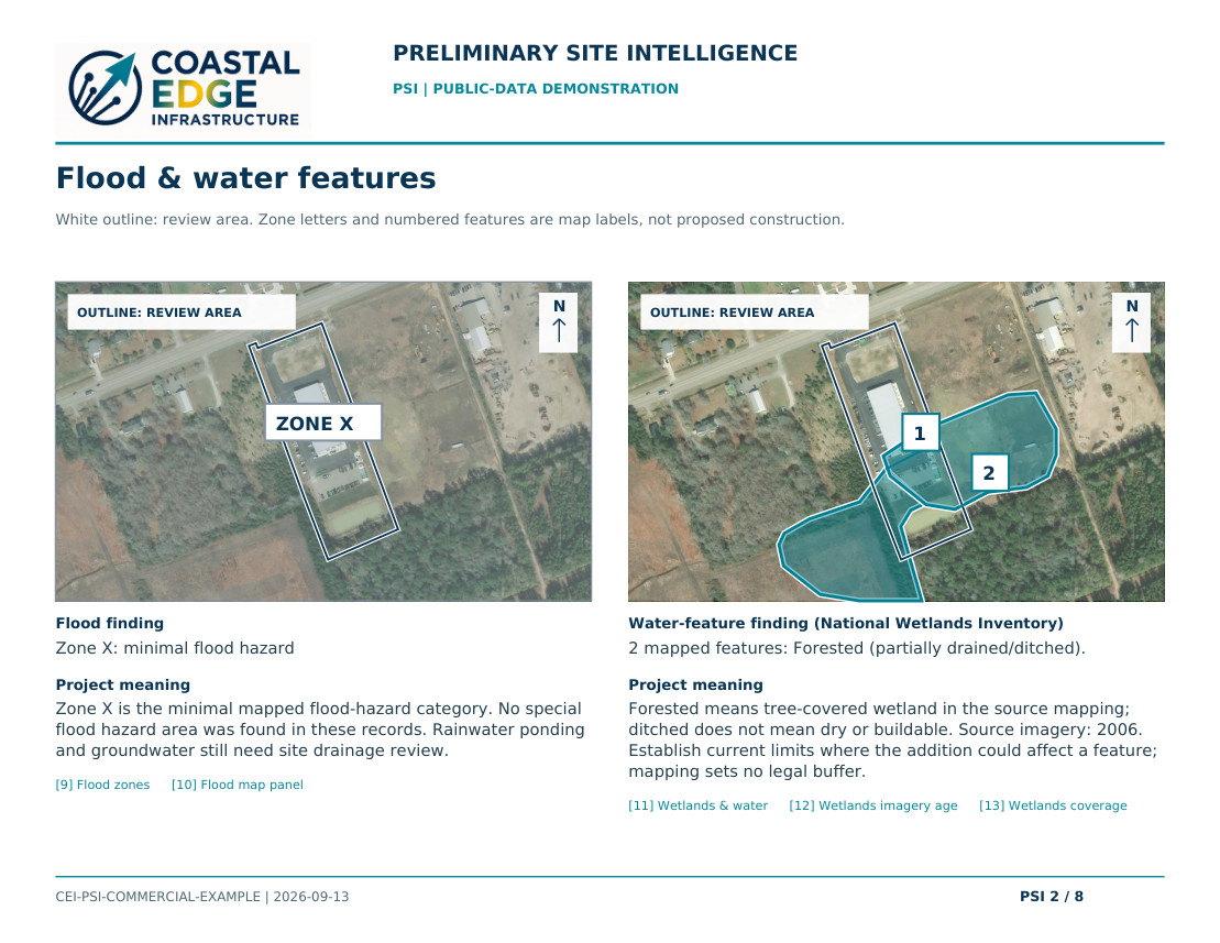
One site. One reviewed report.
$49 one-time · review included
Choose your site, confirm the map outline, and receive your report after our review. Target delivery is within three business days after the order and required information are complete.
Uses existing records; no site visit or new aerial photography. It does not establish surveyed boundaries, buildability, permit approval, or utility capacity.
The selected map area is not a surveyed boundary. Maps can be incomplete or dated. Actual wetlands, legal access, ownership, and service availability require further confirmation. Your verified preliminary-report payment can be credited once toward an aerial assessment, with no expiration.